 | |
| Suburbs: | |
|---|---|
| Named after: | Harry Ord |
| Connects with: | |
| Wikidata: | Q17846349 |
| OpenStreetMap: | 9361935 |
-32.048159, 115.753724 | |
You may wish to contribute to that article in preference to this one, so that your contributions may be of use to the greatest number of people.
Of course, anything that is not suitable for Wikipedia can be added here on Freopedia instead (within reason).
Buildings
]
Ord Street was named for Major-General Sir Harry St George Ord (1819-1885), who was Governor 1877-80. It was Ord who turned the first sod of the Fremantle to Guildford Railway in 1879 or 1880.
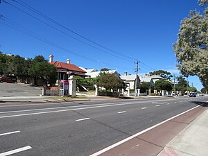
Ord Street connects Hampton Road with James Street (at [[../people/finnerty.html|Finnerty]] Street), and so is the major north-south thoroughfare through Fremantle, as Hampton Road continues south towards Rockingham as Cockburn Road, while at the northern end James Street intersects with Queen Victoria Street, which conveys traffic to the (old) Fremantle Traffic [[../bridges/index.html|Bridge]]. Ord Street becomes Hampton Road at the corner with Knutsford and Stirling Streets.
It was originally intended that Stirling Street would join with James Street ([[../people/stirling.html|James Stirling]] having been the first governor of the colony), but it was decided not to make a road across Fremantle Park. Now Ord Street does the joining, a little to the east, and along the line of the edge of the level space which had been formed to make Fremantle Park. Above that line, further to the east, there is a rocky rise which still exists. That eastern area was originally part of Fremantle Park, but was resumed for educational purposes, and John Curtin College is now on the higher land.
To make Ord Street, it was necessary to obliterate what was formerly the grounds of the [[../buildings/asylum.html|Asylum]] (now the Arts Centre).
Fremantle Library Local History Collection photo #ES00461, Murray Edmunds, 1968: Ord Street under construction. View looking north from Ellen Street. Shows the former Fremantle Lunatic Asylum (1861-1865, 1886-1896). Conservation work began in 1968 to convert the building to a Museum (opened 1970) and Arts Centre (opened 1972).
The portion of this road between Knutsford Street (formerly Hill Street) and Ellen Street (formerly John Street) was formerly Hampton Road.
Asylum Road, shown by dotted lines on the map, was the track that would have linked the Asylum to the Prison. Part of it was close to the alignment of present Ord Street. An Old Boy of Fremantle CBC said that, when he was a boy at the college, that road still existed, and the boys called it 'the goat track'. Ord Street was not laid down until the 1960s. Hutchison 2009.
Houses of interest in Ord Street
[[../buildings/samsonhouse.html|Samson House]] is at the corner of Ord and Ellen Streets. It was built for Michael Samson and left by his son, Sir Frederick Samson, to the WA Museum.
[[../buildings/lenaville.html|Lenaville]] is at the rear of Samson House, on the corner of Ord Street and the High Street.
On the other side of High Street, [[../buildings/ivanhoe.html|Ivanhoe]], [[../people/lilly.html|James Lilly]]'s magnificent residence, once stood near the corner, at 8 Ord Street. It was demolished in 1966.
The houses at 12, 14, and 16 (all extant) were built by [[../people/holdsworth.html|Lionel Holdsworth]] as rented investment properties.
18-22 Ord Street (two houses) are B&Bs called Fothergill's.
24 Ord Street is on the corner of Knutsford Street - after which the name changes to Hampton Road.
The Heritage Council treats the buildings in the area as the "Ord and Bateman Street Precinct".
References and Links
Hutchison, David 2009, 'A history of Fremantle Park', City of Fremantle.
This page incorporates material from Garry Gillard's Freotopia website, that he started in 2014 and the contents of which he donated to Wikimedia Australia in 2024. The content was originally created on 10 August, 2017 and hosted at freotopia.org/streets/ord.html (it was last updated on 18 November, 2023), and has been edited since it was imported here (see page history). The donated data is also preserved in the Internet Archive's collection.


